
Maybe this is a consequence of our first winter after two and a half years in Ecuador, but it seems like the weather went from pleasant to cold overnight. We’re officially in the dark season; the grey skies and 4:30 p.m. sunsets have set in. Readjusting to seasons after so much time with stable temperatures and daylight hours hasn’t been terrible, but I do miss the consistency.
Before the big switch, we went to the mountains for one final day of fall hiking. Our goal this time was Breitenstein, a ~1600 m (~5300 ft) peak in the Bavarian pre-Alps.
For us, the hike started at the Fischbachau Bahnhof, about 1 hour 15 minutes south of Munich. The nice part about train-accessible hikes is that they are (obviously) train-accessible. The downfall is that it took about 45 minutes to get from the train station to the real start of the trail. Although we always download offline maps, they aren’t always the easiest to follow, depending on the route. So, this time, we relied a bit more heavily on the yellow signposts (with walking times) characteristic of hiking in Bavaria.
If you’re interested in retracing our steps as a day hike from Munich, then follow these signposts: Fischbachau Bahnhof–Wolfsee–Kesselalm–Breitenstein–Breitensten Westgipfel (west summit)–Bucheralm–Fischbachau–Fischbachau Bahnhof.

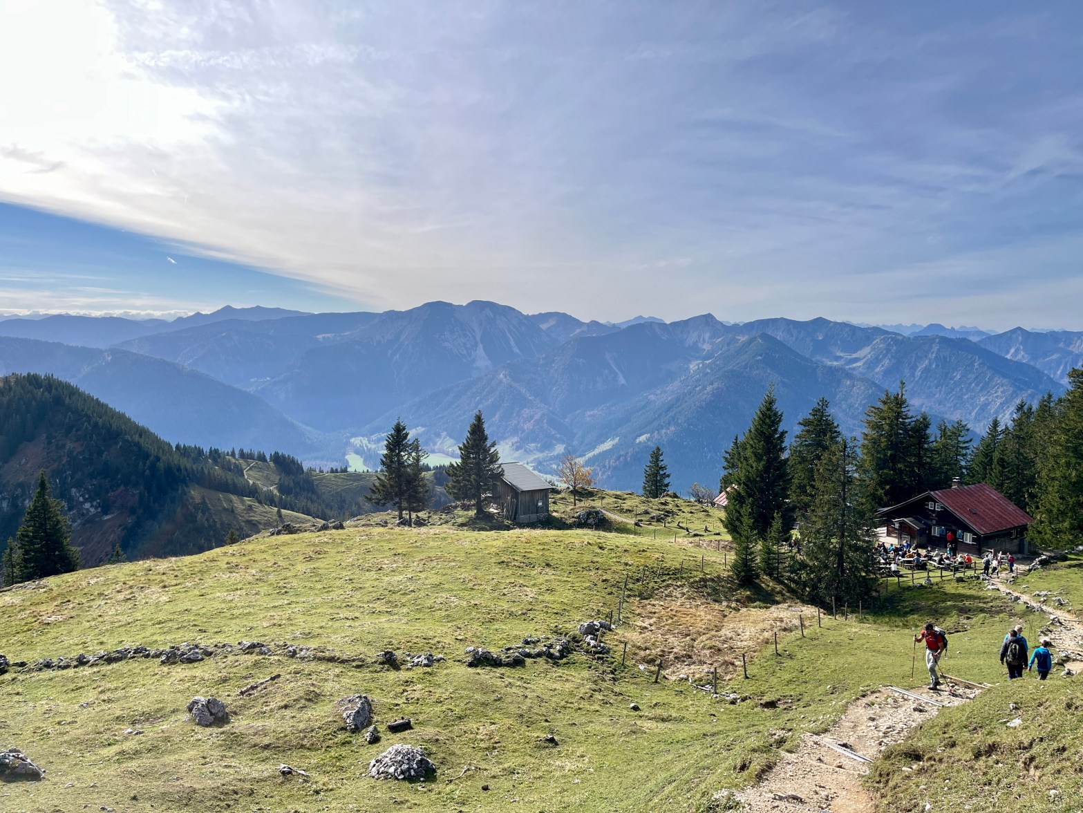
This hike started as a nice walk through the woods–nothing too strenuous. It was quite foggy in Munich and at lower elevations. However, by the time we reached the Kesselam for lunch, we were above the clouds and in the sunshine. As always, you can bring your own food, but you should buy a drink. My new favorite mid-hike beverage is Apfelschorle, a 25:75 mixture of apple juice and sparkling water. It’s very refreshing!


From the Kesselalm, it was another hour-ish uphill to the summit of Breitenstein, which had the coolest view with the clouds that day!


Bonus: The Breitenstein west summit (westgipfel), with a nice view of the main summit. Two summits in one trip; what more could a gal ask for?!

Practical Info
How to get there: Easy – by train! There is a regional train from Munich to Lenggries every 30 minutes. Bonus: This route qualifies for the Bayern Ticket, so it only costs €39 euros for 2 people (if you don’t have the Deutschland ticket) and gets you all-day access to local and regional transport.
Distance from Munich: ~1 hour and 15 minutes by train.
Hike Direction: Follow the yellow signs for the Wolfsee from the train station. From there, you’ll start seeing signs for waypoints further into the route.
Difficulty: Moderate. The path required more sure-footedness, and the elevation gains to the summit (and then back down) were moderately challenging at times. The total elevation gain was 930 m (~2650 ft), and what goes up must come down…
Time: We walked about 16.5 km (10 miles) in a little over 5 hours, not including the stop for lunch.
Tip: Bring cash for any purchases at the huts.
Rating: ✅ Highly Recommended!
This was our last hike for the season, but thats ok. Why, you ask? Because it’s glühwein season, folks! For the next 6 weeks, you can find me at die Weihnachtsmärkte!

Tschüss,
